

Chicksand Street
Hi,
any chance of an overlay showing location at 5 Chicksand Street and 163 High St Road Whitechapel as it was in 1888.
Having difficulty locating the house numbers on current maps of Whitechapel.
regards
Eileen
-
a link
Here are the bacon maps in the form of a KMZ file. Dave
Leave a comment:
-
and in relation to the murder district
The new station in relation to the killing field. DaveAttached FilesLeave a comment:
-
-
Colin was absolutely correct. The refined Bishposgate plot is below. I will redouble my efforts as I assume he is correct about my performance as well. Thank You, Colin. DaveAttached FilesLeave a comment:
-
-
no apology necessary
As far as I can remember all cop shops stem from maps. I will investigate further and remedy the discrepancies. Thank You. DaveLeave a comment:
-
 Guest repliedI owe you an apology!
I shelved your request for help, with some Police-Station plots, and forgot about it. In the process, I inadvertently misplaced the map that you included, in your e-mail.
Here's something that I compiled a few years ago.
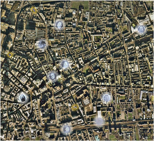
Known Murder/Disposal-Sites: 'Whitechapel Murders' (Less 'Rose' Mylett) 1888-1891 (Click to Enlarge in flickr)
Underlying Aerial Imagery: Copyright Google Earth, 2007
Overlying Plots, Labels and Color-Shadings: Copyright Colin C. Roberts, 2010
It includes the following police stations:
- Bishopsgate Police Station, City of London Police Force, Sixth Division; Bishopsgate Street Without, Parish of St. Botolph without Bishopsgate, City of London *
- Commercial Street Police Station, Metropolitan Police Force, H Division; Commercial Street, Parish of St. Leonard Shoreditch / Liberty of Norton Folgate / Parish of Christ Church Spitalfields, County of Middlesex **
- Leman Street Police Station, Metropolitan Police Force, H Division; Leman Street, Parish of St. Mary Whitechapel, County of Middlesex
* You have thus far, plotted this station incorrectly.
** The Commercial Street Police Station straddled the boundaries of the three named parochial entities
---------
A database of Google Earth plots, relevant to the mystery of 'Jack the Ripper', is a very worthwhile endeavor; and the level of enthusiasm that you have exhibited for this project is indeed admirable.
But, I would strongly urge you to strive for improvement of the accuracy of your plots, as well as the quality of your presentation.
And, rather than asking for this plot -or- that plot, from other posters; you should be doing your best to locate all of the relevant landmarks yourself. That is the means, by which you will learn the 'lay of the land'.
I wish you the best of luck, with this most worthwhile endeavor!Leave a comment:
-
3 in 1
The brown smear is modern London, the white overlay is the 1888 postal sirectory map, and the red field is the killing field. DaveAttached FilesLeave a comment:
-
-
the old and the new
Overlay is mitre square 1873. Kickass building to the left is the gherkin. DaveAttached FilesLeave a comment:
-
-
map fitting 101
When fitting maps to GE it is always a matter of which points you reference. In this image you see an 1873 detail of George yard that does not seem quite right. Yet this detail was fitted to an 1894 overlay that is with 10's of feet (16) to be exact. When you compare the 1873 alignment with the modern one, it seems screwy, I assure you it is not. DaveAttached FilesLeave a comment:
-
-
Neil in 1868
Who knew the man had a time machine? With a larger section of the 1868 map I could fix that alignment problem. DaveAttached FilesLeave a comment:
-
-
P.C. Neil in 1802
What? It could happen! DaveAttached FilesLeave a comment:
-
-
and the times, they are a changin'
dorset street, 1681 and dorset street 2010. DaveAttached FilesLeave a comment:
-
-
map notes
While a great deal can be done in the scaling of maps, there are limitations. Bear in mind, these maps were made by hand, in a time when a chain was the preferred distance measuring method. There will never be a 1 to 1 correlation. This revised method is as good as it gets. The images on geII are designed to get a feel for the geography and get rough measurements of distance and time. This revised fitting method is well within the margin of error for the original map makers. instead of 100 percent being perfect, think 70 percent. I am now well above 70% but how far is irrelevant, there will be no more revisions on fitting. DaveLeave a comment:
-
revised method of syncing
I have changed my method of jiving map to ge. Here is the result. Image 1 with, image two, same field without the overlay. It almost made the GIS prof poop himself. DaveAttached FilesLeave a comment:
-
-
It has occurred to me
On the torso plots I did not give the range. The line is 14.90 miles. DaveAttached FilesLeave a comment:
-


Leave a comment: